Is It Safe To Drive From Mexico City To Grutas De Tolantongo?
An honest look at the 201 km drive from Mexico City to Grutas de Tolantongo: the mountain descent, night driving, tolls, cash rules and the guided alternatives.
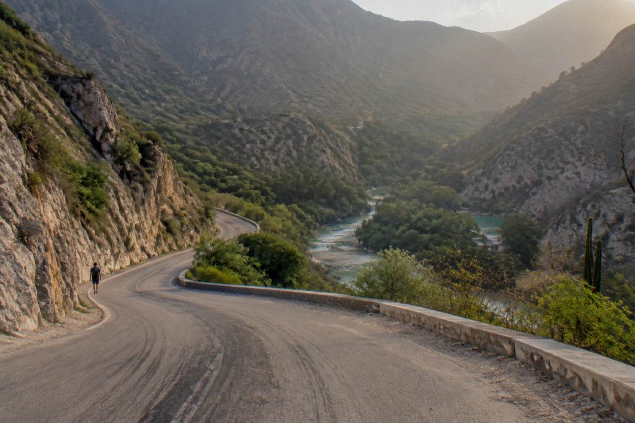
Yes, for a careful driver in daylight the route is generally considered safe, and the park itself publishes driving guidance for it. The trip is 201 km from Mexico City and takes roughly 3 hours 50 minutes per the park's official distances page. The part that demands real attention is not the highway; it is the final 20 km descent into the Tolantongo canyon, a paved but tight, steep mountain road where the official advice is to descend in first and second gear. Once you've handled that canyon descent, the full safety guide to Grutas de Tolantongo walks you through the risks inside the park, from slick stone paths to the river rules.
The question gets asked constantly, and for good reason. Tolantongo sits in a deep canyon in the Mezquital Valley of Hidalgo, at 1,280 m above sea level, and the mental picture of a mountain road with a thermal river at the bottom makes people imagine something far worse than the reality. The Mexico City to Ixmiquilpan portion is almost entirely modern toll road and free highway through flat valley towns. Only the last stretch, after Ixmiquilpan, becomes the winding canyon road people worry about.
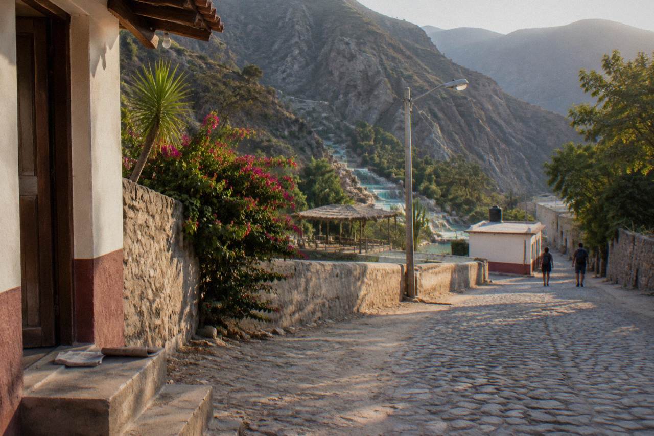
That last stretch is the honest crux of this article. The park's own getting-there page describes it plainly: a paved descent with tight curves where drivers of automatic cars should use first and second gear to control speed on the way down. That is not a warning that the road is dangerous; it is normal mountain-driving technique, the same advice given for any steep grade with curves. What it does mean is that the road rewards drivers who take it slowly and punishes those who treat it like the highway they just left.
For anyone whose stomach tightens at that description, there is a well-trodden alternative: shared and private tours that take the whole drive off your plate. The small-group cave tour from Mexico City, rated 4.7 across 724 reviews, handles the route with a professional driver, and the full-day Exploring the Waters tour, 4.8 across 1,575 reviews, does the same with hotel-area pickup. Both cost from $132 to $134 per person, which is often less than a rental car plus fuel plus tolls for two people once the day is tallied.
What Is The Route From Mexico City To Tolantongo?
The official route runs 201 km: the Mexico-Pachuca autopista out of the city, a left exit before Pachuca onto the road to Actopan and Ixmiquilpan, then the Pachuca-Ixmiquilpan highway and the Libramiento a Cardonal at Ixmiquilpan, following signs to the park. The park's official distances page puts the drive at 3 hours 50 minutes from Mexico City, with tolls of roughly 127 MXN on the autopista for a car.
The first three quarters of the drive are unremarkable in the best sense. The autopista to Pachuca is a divided toll highway, the kind of road you take to anywhere in central Mexico without a second thought. After the exit toward Actopan the character changes to a free two-lane road through valley towns, still flat, still easy, but with the usual Mexican highway traffic of buses, trucks and the occasional slow tractor. The official page for the route is the park's how-to-arrive page, which walks through exactly these turns.
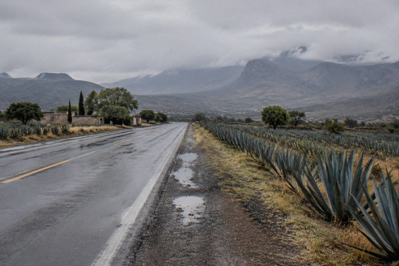
After Ixmiquilpan the road starts to climb and then descend into the canyon. A travel blog covering the route describes an initial straight section through the Mezquital Valley followed by the winding descent, and recommends full driver attention and daytime travel for the final approach. That matches everything the official site says about the last 20 km. Cell signal, by the same account, drops out roughly 20 minutes before the park, so downloading offline maps while still in Ixmiquilpan is sensible preparation rather than paranoia.
How Difficult Is The Final Descent Into The Canyon?
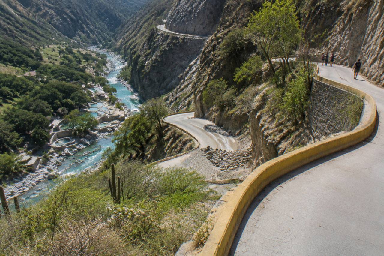
The final 20 km are the hardest part of the drive: a paved mountain road with tight curves, steep grades that one route guide puts at up to 14 percent, one lane per direction in most sections and no shoulders in the narrow parts. It is a normal road that locals drive daily, including combi drivers and delivery vehicles, but it is a road for low gears and no rushing.
The park itself, not a blog, is the source of the gear advice. The official getting-there page tells drivers of automatic transmission cars to descend in first and second gear, which is the clearest signal of how steep sections of it are. That grade figure deserves honest framing: the 14 percent number comes from a secondary route guide, not the official site, so treat it as an approximation of the steepest pitches rather than a surveyed constant. Either way, the technique is the same one used on mountain roads anywhere in the world.
What makes the descent manageable is that it is short and well used. Combi drivers run it several times a day, the park's own internal vehicles use it constantly, and the surface is paved end to end, not the dirt track some visitors imagine. The real hazards are behavioral: drivers who ride their brakes until they fade, drivers who cross the center line on blind curves, and impatience. Going up is easier on the brakes than coming down, and most people leave the park in late afternoon with plenty of light, which is exactly the right condition for it.
For anyone weighing whether to drive, the deciding questions are simple. Are you comfortable on mountain roads with drop-offs and curves? Are you doing the descent in daylight? Do you have a co-driver or at least offline maps? Two yeses out of three and the drive is reasonable. Zero yeses, and a guided day trip is the better call, which is exactly why the tour alternative at the end of this article exists.
If the descent is the dealbreaker but you still want flexibility at the park, the private tour option deserves a look. A 100% private tour to the Tolantongo hot springs from Mexico City, rated 4.8 across 189 reviews and from $167 per person, gives you a dedicated driver for the canyon road and your own schedule on site.
The same operator-free logic applies whichever way you book: whoever drives that road for you does it every week, and the price of handing it over is modest next to a rental, fuel, tolls and parking. It is worth pausing on that arithmetic before you commit to the wheel.
Is Night Driving To Tolantongo A Good Idea?
No, and this is one point where the advice is unambiguous: plan the drive in daylight, both directions. The canyon descent relies on reading curves, grades and oncoming traffic, none of which is forgiving after dark, and the route guidance for the area explicitly recommends daytime travel. The park's ticket office runs 6 am to 11 pm, so a late-evening exit tempts people, but leaving before dusk beats leaving after it.
Night adds three specific problems to an already demanding road. The curves hide headlights until the last moment, the absence of shoulders leaves no margin for error, and fatigue after a full day of soaking in hot springs is real, even for passengers who then take the wheel. There is also the matter of animals and slow vehicles on the valley roads between Actopan and Ixmiquilpan, which are poorly lit between towns. None of this makes night driving impossible; locals do it. It makes it a poor trade for a visitor who can simply time the day differently.
The practical fix is to anchor the day at the front. Arrive early, which the park rewards anyway since pools, caves and the zipline open at 8 am, and plan the departure with a cushion. Most guided tours solve this by design: a typical small-group departure meets around 5:30 am in Mexico City according to one listing, spends roughly four hours at the park in the early afternoon window, and is back on the highway long before dark. That structure is not an accident; it exists partly because operators do not want their vans on the canyon road at night either.
For independent drivers, the same clock applies. Aim to be through Ixmiquilpan by late afternoon at the latest, and if you have stayed for the evening river hours, accept a slower, more cautious descent or an overnight near the park rather than racing the sunset. The park's own lodging sections, described in our guide to staying overnight at Tolantongo, are one legitimate way to avoid the after-dark exit entirely.
| Point on the route | Distance to the park | Official drive time | Road character |
|---|---|---|---|
| Mexico City | 201 km | 3 h 50 min | Toll autopista then free valley highway |
| Pachuca | 117 km | 2 h 28 min | Free road via Actopan, valley towns |
| Actopan | 82.4 km | 1 h 49 min | Free highway, buses and slow vehicles |
| Ixmiquilpan | 42.9 km | 1 h 11 min | Straight valley section, then the canyon descent |
What About Tolls, Fuel And Cash On The Route?
Budget roughly 127 MXN in tolls each way for a car on the Mexico-Pachuca autopista, per 2026 tariff listings, with the Pachuca to Ixmiquilpan stretch free. Fuel and cash are the bigger planning items: the park states it takes cash only for everything inside, including entrance, parking and restaurants, and the nearest ATM is in Ixmiquilpan, about an hour away. Fill the tank and withdraw cash in Ixmiquilpan, or better, before leaving Mexico City. If you would rather build the trip around a base city than a long same-day drive, the comparison of the closest cities to Tolantongo weighs Ixmiquilpan against Pachuca, Querétaro and Mexico City.
The cash point is the one that catches visitors. Entrance is 230 MXN per person per day, parking is 50 MXN per vehicle, and card payment is not accepted anywhere in the park. There is no ATM in the canyon. Ixmiquilpan is the last full-service town, and it is the right place to top up fuel even though the park's home page now advertises a fuel station 15 minutes away, since that station's exact location is not published. A day for a family of four can easily mean over 1,000 MXN in park costs before food, so plan the withdrawal with the entrance-fee guide in mind; our page on Tolantongo entrance fees and tour prices breaks down every MXN cost.
Signal is the other preparation item. Mobile coverage drops out on the final approach, reportedly around 20 minutes before the park, and the park notes only Telcel works inside. Offline maps downloaded before Ixmiquilpan, a paper note of the park's published phone numbers, and a full tank remove most of the things that turn a minor problem into a stressful one. Breakdown assistance in a canyon with no signal is slow everywhere in the world; Hidalgo is no exception.
One more honest note on the road itself: there is no verified information about current roadworks on the Ixmiquilpan to park stretch, and conditions on mountain roads change seasonally. Check locally, either with your hotel in Mexico City or by asking in Ixmiquilpan, before committing to the final descent. The official park site is the park's information page for current operational notes, and its transport page carries the combi schedule if you decide to leave the car in town.
Is The Drive Different In Rainy Season?
Yes, and rainy season, roughly June to September, is when the case for caution is strongest. The park's own pages tell visitors to stay away from the river in heavy rain and follow security staff, and its camping guidance says not to camp by the river in late July and August. Rain on a steep canyon road means reduced grip and standing water in curves, so slow down and consider postponing rather than pushing through a storm.
The canyon does what canyons do in rain: water concentrates, surfaces slicken, and the margins that were comfortable in dry weather shrink. None of the official guidance forbids driving the road in rainy season, and the park stays open 365 days a year. But the same judgment that keeps you off the river in a downpour should keep you off the descent in one. Waiting an hour in Ixmiquilpan for a storm to pass is a minor cost; the alternative on a wet 14 percent grade is not.
Outside the rainy window the drive is at its easiest from October to December, when the region is dry and the river runs its clearest. Cold-season nights from December to March are notably cooler, which matters for the return leg if you leave late: a jacket for the passengers and a warm-up plan for the driver both help. Seasonal planning in general is covered in our guide to the best time to visit Tolantongo, which pairs the road question with the crowd question.
What Is The Tour Alternative To Driving Yourself?
Skip the drive and book a guided tour from Mexico City: shared options run from $78 to $140 per person, private trips are also available, and each one puts a professional driver on this exact route. The most-reviewed pick is the Full-Day Tour Exploring the Waters of Tolantongo, 4.8 across 1,575 reviews, from $134 per person, while the cheapest shared day is the Full Day Tolantongo Caves listing from $78.
This is the decision the whole article funnels toward. If reading about first-and-second-gear descents made you relax, drive; the road is well within the abilities of a normal careful driver in daylight. If it made you tense, the tours are not a consolation prize, they are the rational choice, and they are the reason this site exists. The small-group tour from Mexico City includes round-trip transport from a central meeting point, a bilingual guide and entrance to the park, which removes the driving, the cash-at-the-gate scramble and the parking question in one booking. Its full inclusions, including the optional box lunch, are listed on the operator's live listing.
Do I need a car at the park once I arrive? No. The park is compact and self-guided, with internal mototaxis and a shuttle between the two zones for a small fee, so a tour bus, a combi or a private driver all deliver you to the same starting point on foot.
Private options suit families and groups who want schedule control without the wheel. The 100% private tour from Mexico City, from $167 per person at 4.8 across 189 reviews, and the private transportation listing at from $333, whose booking page shows whether the price is per person or per vehicle, bracket the range. For a fuller comparison of private versus shared formats, including the Querétaro departures, see the guide to choosing a private or small-group Tolantongo tour. Whichever you pick, the mountain road becomes someone else's daily commute, and that, per Grutas de Tolantongo Tours, is a perfectly good way to answer the safety question.
Common Questions About Driving To Tolantongo
Is it safe to drive to Tolantongo from Mexico City?
Yes, in daylight and with care. The route is 201 km, about 3 hours 50 minutes per the park's official page, mostly toll road and valley highway. The last 20 km are a paved but steep, curved canyon descent; the official advice is to use first and second gear in an automatic. Avoid it at night and in heavy rain.
How long does the drive take?
The park's official distances page lists Mexico City at 201 km and 3 hours 50 minutes. Real door-to-door time from central Mexico City typically runs longer with traffic and stops. Guided tours budget about 14 hours for the full day including roughly four hours at the park.
Is there cell signal on the road to the park?
Coverage drops on the final approach, reportedly around 20 minutes before the park, and the park states only Telcel works inside. Download offline maps before Ixmiquilpan and carry cash, since the park takes cash only and the nearest ATM is in Ixmiquilpan.
Can I take a bus instead of driving?
There is no direct bus to the park. Buses from Mexico City's Terminal Norte to Ixmiquilpan stop at Molanguito, 8 km short, where a shuttle covers the rest. A direct combi runs from the San Antonio parking lot in Ixmiquilpan to the park for 80 MXN each way, about 50 minutes.
When should I avoid the drive?
Avoid the final descent at night and in heavy rain during the June to September rainy season. The park's own guidance warns against the river in rain and camping by the river in late July and August; the same caution applies to the canyon road in a storm.